Aree Fornaci Romane
Prospezioni geofisiche sono state effettuate in due aree con presenze di industrie per la produzione di laterizi e ceramica d’epoca romana.
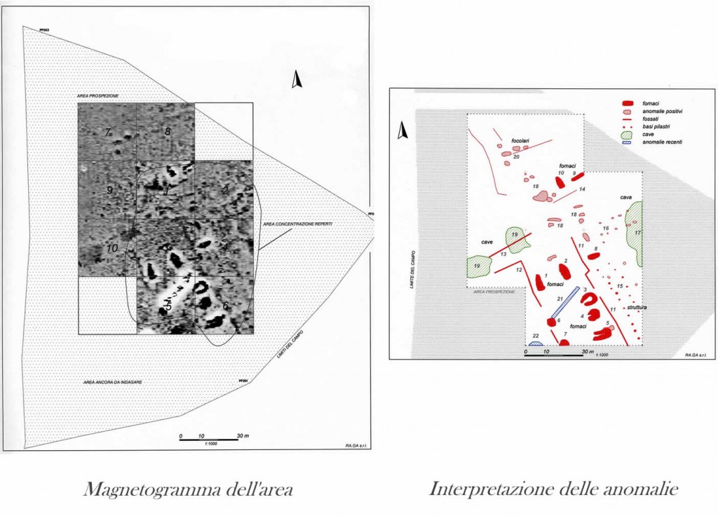
Una di queste aree è presentata sopra: si vedono le forti anomalie di dieci fornaci, delle cave per l’estrazione di argilla, dei solchi dei muretti lignei che delimitano le aree delle fornaci e le basi in laterizi dei grossi porticati dove venivano asciugati i prodotti.
Romano:
- Rosso – fornaci, pilastri, recinzioni
- Rosa – buche
Recente:
- Blu – tubazioni ferrose
I siti ben conservati sono rari e la planimetria di parte del complesso è ben rappresentata qui anche senza aver effettuato lo scavo archeologico.
A Roman pottery industry
A geophysical survey was conducted in two areas known for roman brick and pottery production.
One of these areas is presented above:
a clear image can be seen of ten kilns, clay quarries, timber wall trenches defining the production area, and the brick bases of large porticoes where the products were dried.
Roman:
- Red – kilns, pillar bases, wall trenches
- Pink – pits
- Green – clay quarries
Modern:
- Blue – iron tubes from a recently demolished farmhouse
These well-preserved sites are rare, and the plan of part of the complex is well-defined even though no archaeological excavation has been conducted.
Instruments used – Geoscan Research gradiometer FM36
